By Jonathan Cabral, Stephane Keil and Edwin Adkins
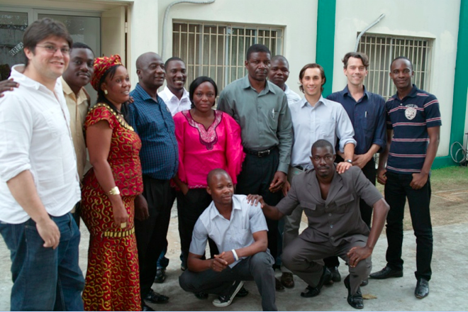
As a part of an ongoing project to support the Liberian government in energy related data-gathering and planning, three members of the Modi Lab conducted a two-week training in Monrovia to prepare key energy and data specialists from Liberian government, the electric utility, and related energy organizations in the use of mobile rapid data-gathering tools to estimate the urban and rural energy demand in the country.
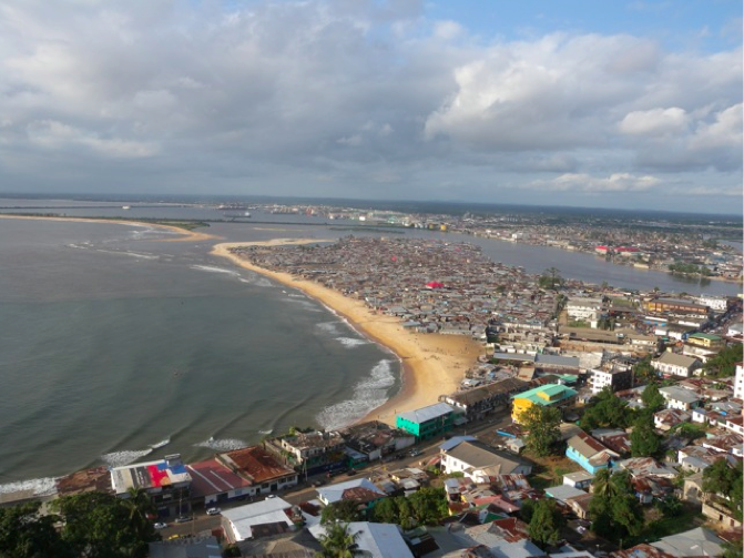
After the end of the civil war in 2003, the Liberian power sector was largely destroyed, leaving less than 1% of Liberia’s population with access to grid electricity. Most of the country’s population relies upon generation at home, independent power producers (IPP) providing electricity by wire from diesel generators, or, in some smaller cities, limited municipal mini-grids. Access to modern energy will be a critical element if Liberia is to restart the process of economic and social development. Since energy needs are urgent and development budgets are limited, an approach is needed that optimizes costs and allows planners to select and prioritize among different generation technologies (grid, solar and diesel, as well as hydro, where available). Mobile data gathering tools can help to geo-locate homes, facilities, commercial and industrial sites, and IPPs – all of which help to quantify electricity demands and current supply.
For two weeks, 20 government and utility employees drawn from 4 core partner organizations –
- the Ministry of Lands, Mines and Energy (MLME),
- the Rural and Renewable Energy Agency (RREA),
- the Liberian Electricity Corporation (LEC),
- the Liberian Institute of Statistics and Geographic Information Services (LISGIS)
participated in a practical training with two key tools: formhub.org (to manage mobile data collection) and Android smartphones running Open Data Kit (ODK), an open-source software for conducting surveys, gathering geographic coordinates, and other media (photos, video) using mobile phones and other devices. The intensive two week training covered all aspects of using Formhub, the process of writing special syntax into Excel spreadsheets creating mobile surveys (“authoring”), the use of Android phones to conduct pilot surveys in locations around Monrovia, and finally, the steps to visualize and analyze the information gathered during the training with software such as QGIS (an open-source GIS software package).
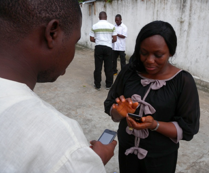
The practical nature of the formhub training allowed the government institutions to select a current need for data collection, define the set of questions required to study the issue and pilot the survey, in preparation for a full scale data gathering effort. During training each organization chose a different data need to fill: RREA designed a survey to understand the cookstove energy needs. The utility LEC took surveys of potential new grid customers to gauge customer demand in unserved areas. LISGIS and MLME, both government agencies, collaborated on a survey that profiled and mapped out Independent Power Producers (IPP) serving electrical needs of Monrovian communities at various scales. The training accommodated versatile needs of each organization with the many features of formhub.
It was interesting testing the formhub data collection process in a challenging environment. Typically, many innovations in the field of ICT4D that function great in big US cities commonly fail as soon as one tries them in the developing world context. We are proud to announce that formhub was successful in proving its functionality under stressful situations of intermittent power and data connectivity.
All participating institutions were provided with Android smartphones to start piloting their formhub based survey efforts. The utility company will start working right away on their Cross Border Needs Assessment. This involves a study of 18 communities close to the border with Ivory Coast that will soon have access to power coming from the neighboring countries. Understanding the power demand of such rural communities will be extremely valuable to parameterize the Earth Institute modeling efforts and improve the accuracy of the different scenarios for the energy grid planning. The other government ministries and agencies are also rapidly forming working groups to pilot formhub-based data collection projects. Our group looks forward to supporting the Liberian ministries and utility company as they continue testing and adopting formhub for their data collection needs.